MONTAGNE DE CAP DE LONG
Contributed by David Sellars
FACTS
Country: France
Location: West of St. Lary Soulan
Round trip: 8 km
Start elevation: 2175 m
Final Elevation: 2600 m
Maps: 1:50,000 Bigorre, Rando Editions Sheet #4
GETTING THERE
From Fabian drive up the paved D929 to the large car park beside the dam at Lac de Cap de Long
PARTIAL PLANT LIST
Myosotis alpestris
Pinguicula grandiflora
Gentiana verna
Rhododendron ferrugineum
Ranunculus pyrenaeus
Linaria alpina
Primula integrifolia
Saxifraga exarata
Androsace laggeri
Primula hirsuta
Petrocallis pyrenaica
Saxifraga oppositifolia
Saxifraga pubescens ssp. iratiana
Daphne cneorum


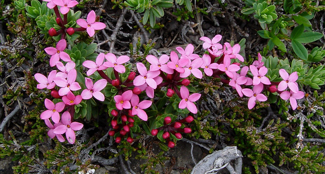
This hike leads to the summit of Pic de Campbieil but there are spectacular flora en route that will distract from making the summit ascent. The trail leads along the south side of Lac de Cap de Long and after about 1 km, climbs steeply up the slope to the south and then traverses along a spectacular rocky path with some scrambling. Daphne cneorum and Rhododendron ferrugineum are common among the rocks. The path then crosses a large boulder field and a tricky stream crossing has to be made that is easier higher up where the stream is braided. On the other side of the stream the path climbs a very steep rocky slope and then reaches a broad hollow at about 2500 m. Androsace laggeri and Primula integrifolia are common in this area
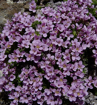
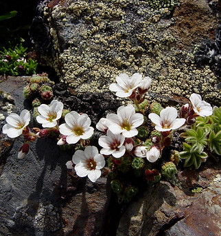
The path to Pic de Campbieil leads up the slope to the right but slightly left at the entrance to a narrow valley there is a dark limestone highly weathered rock outcrop emerging from igneous boulders and there are a variety of interesting alpine flowers in this area. Both white and lilac forms of Petrocallis pyrenaica can be found here together with Saxifraga pubescens spp. iratiana, (a Pyrenean endemic), hybrids of Saxifraga oppositifolia and Primula hirsuta. On the return, watch out for Pinguicula grandiflora on the wet rocks above the path.
Reference: Rother Walking Guide, Pyrenees 2, Roger Budele
MONTAGNE DE CAP DE LONG GALLERY.
The photos were taken on July 3, 2007
Click the arrows to start the slideshow or click on an image to expand.


